Anticipating Another Sumatran Tsunami
Research by the California Institute of Technology, the University of Southern California, and Indonesian scientists indicates that within the next few decades another big tsunami could flood densely populated sections of western coastal Sumatra, south of those that suffered from the devastating tsunami of December 2004.
Four researchers at Caltech and USC have modeled the dynamics of past and plausible future tsunamis.
They hope that such detailed calculations of tsunami characteristics will speed preparations that could save lives. Their work will appear in the Proceedings of the National Academy of Sciences (PNAS) on December 4.
Kerry Sieh, a professor of geology at Caltech and one of the participants in the study, explains, "When we tell people living along this 700-kilometer section of the Sumatran coast that they will likely experience a big tsunami within the next 30 years, they ask for details. How much time after the earthquake will they have before the tsunami strikes? How big will the waves be? How far inland should they be prepared to run? What areas are likely to suffer tsunami damage? This paper is our first attempt to answer these important questions."
The same big fault, or megathrust, that caused the tsunami of 2004 extends much farther southeastward, beneath the Indian Ocean, just off the southwest coast of Sumatra. Rupture of this section of the megathrust, under the Mentawai Islands, produced two great quakes and tsunamis in 1797 and 1833. Such events appear to recur on average every 230 years.
Samples of coral from the islands show how much these previous quakes lifted the seafloor. The patterns of uplift gave the scientists the information they needed to do computer simulations of the historical tsunamis. Costas Synolakis, director of the USC Viterbi School of Engineering's Tsunami Research Center, says that the impact of the computed 1797 and 1833 tsunamis is consistent with historical accounts.
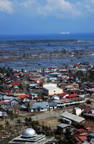
This consistency increased the scientists' confidence in using the same model to evaluate worst-case scenarios for future tsunamis, which, according to Jose Borrero, lead author of the study, "confirm a substantial exposure of coastal Sumatran communities to tsunami surges." For example, two river valleys near Bengkulu, a coastal city of about 350,000 people, experience flooding that extends up to several kilometers inland.
In the models of future tsunamis, offshore islands appear to shield the larger city of Padang somewhat, but even there the 1797 tsunami reportedly carried a 200-ton English ship into the town, approximately a kilometer upstream, and smaller vessels were carried yet further.
"The population of Padang in 1797 and 1833 was a few thousand," Sieh says. "Now it is about 800,000, and most of it is within a few meters of sea level. We hope that these initial results will help focus educational efforts, emergency preparedness activities, and changes in the basic infrastructure of cities and towns along the Sumatran coast," Adds Synolakis, "The message of the 2004 tsunami has not been lost in the research community. We are trying to be proactive and help prevent a disaster like Aceh in 2004."
This tsunami study is the work of four Southern California researchers. Jose Borrero is a scientist at USC's Tsunami Research Center. Kerry Sieh is the Robert P. Sharp professor of geology at Caltech. Mohamed Chlieh is a postdoctoral scholar at Caltech's Tectonics Observatory. Costas Synolakis is a professor in the department of civil and environmental engineering in the USC Viterbi School of Engineering and director of its Tsunami Research Center.
posted by Scott Nance at
12/05/2006 06:09:00 PM
![]()
![]()


0 Comments:
Post a Comment
Subscribe to Post Comments [Atom]
<< Home